How to Choose the Right Reality Capture Method for Your Project
By Procon Project Manager Dante Loza, PE
For the built environment, accurate data is everything.
Whether you’re in active construction, planning a renovation, or operating an existing facility, uncertainty can be costly. Unforeseen conditions lead to delays, rework, and disputes. This has become an accepted reality of our industry – we don’t really know what’s behind the walls.
However, there’s a better way.
Reality capture eliminates uncertainty. Procon is breaking down the two different methods for reality capture to help you find the best fit for your project.
What are the different methods?
360° Photo Capture: Photos are taken with a dual-lens camera system that creates an image with a full 360º field of view. A series of these can be stitched together to show an immersive, navigable view of a space. Think Google Street View or Matterport Tours.
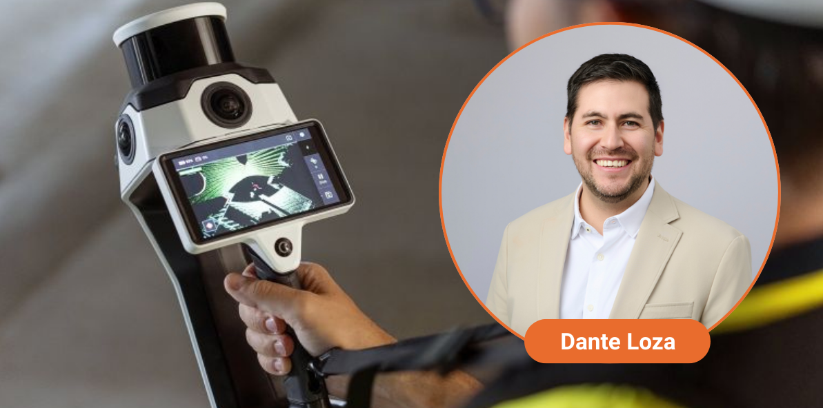
LiDAR (Light Detection and Ranging) Scan: LiDAR is a technology that uses lasers to measure the distance of objects with a very high degree of precision. It’s used in everything from anti-collision systems in cars to iPhones. Technicians walk the space with scanners using this tech to generate a 3D point cloud model.
How does the reality capture process work?
360° Photos –
Equipment: 360 Photo Camera – an off-the-shelf consumer camera, usually smaller than a phone, that costs less than $1,000.
Process and Personnel: Mount the camera to a hard hat, open your app of choice from services like Reconstruct or Drone Deploy, and start walking. Repeat as frequently as you want to document evolving conditions over time during active construction. This can be done by an inspector or other personnel who is already walking the site frequently. Thanks to intuitive software and familiar tools, training someone new to use the technology takes roughly 30 minutes.
Time: Document 25,000+ SF in 10 minutes. The capture process is easily integrated into existing site walk processes, so minimal additional time is needed for capture.
Results: Visual Truth. Immersive visual documentation of conditions with comprehensive, indisputable proof of what is and isn’t there in a way that even the best reports, descriptions, and non-360° photos can’t match.
Benefits: Up to a 40% reduction in claims. Faster dispute resolution. Discounts from insurance providers. Near real-time insight into site conditions from anywhere with an internet connection. Fast, easy, cost-effective.
LiDAR Scanning –
Equipment: Specialized body-mounted system or handheld scanner for tight spaces. The NavVis MLX is a professional, agile handheld scanning system that delivers outstanding data quality, ideal for confined spaces and frequent scans. The NavVis VLX3 is a wearable scanning system for large existing buildings with technical complexity, comprehensive accurate indoor and outdoor reality capture.
Process: An experienced technician uses the scanner to capture the facility. This can be done while a building is occupied with minimal disruption.
Time: The VLX can capture 25,000-40,000 SF in 1 hour. The MLX can capture 4,000-6,000 SF in 45 minutes.
Results: Measurable Truth. A point cloud model with accuracy up to 1/4 inch that can serve as reliable as-builts, integrate with BIM software, and be the base layer for a digital twin.
Benefits: Unparalleled accuracy in documenting project conditions with rapid, high-standard data capture. This ensures that as-built drawings and BIM models are validated and corrected, eliminating the errors and uncertainties that often compromise traditional documentation.
Which one should you use for your next project?
The short answer is probably both.
360º Photos are an accessible, cost-effective way to document conditions. The more you use it, the more valuable it becomes. The insurance policy discount it provides during the construction process is such a no-brainer that we recommend it on every project. But it has limitations. It’s not as precise and is not as effective in low-light conditions.
Those are the ways in which LiDAR shines. It delivers measurable accuracy that can be critical. But it’s more time-intensive and requires specialized equipment and personnel. That means it’s impractical to repeat with the frequency you would with 360º photos. And sometimes that degree of precision simply isn’t necessary.
In many cases, a hybrid approach offers the best solution. Teams can use 360º photo capture throughout active construction to provide real-time documentation, then deploy LiDAR scanning at key milestones, such as before close-in and at project completion, to create highly accurate as-built models. These models can also serve as the foundation for building lifecycle management tools, including a digital twin.
Ready to learn more? Reach out to me at dloza@proconconsulting.com, and let’s get the conversation started on how Procon can support your reality capture needs.
